Equipment

Our lockers are full of a bunch of equipment from safely gear thru to the fun stuff. Some of it we use on a daily basis and some of it we hope we will never ever use, but here is a partial list.

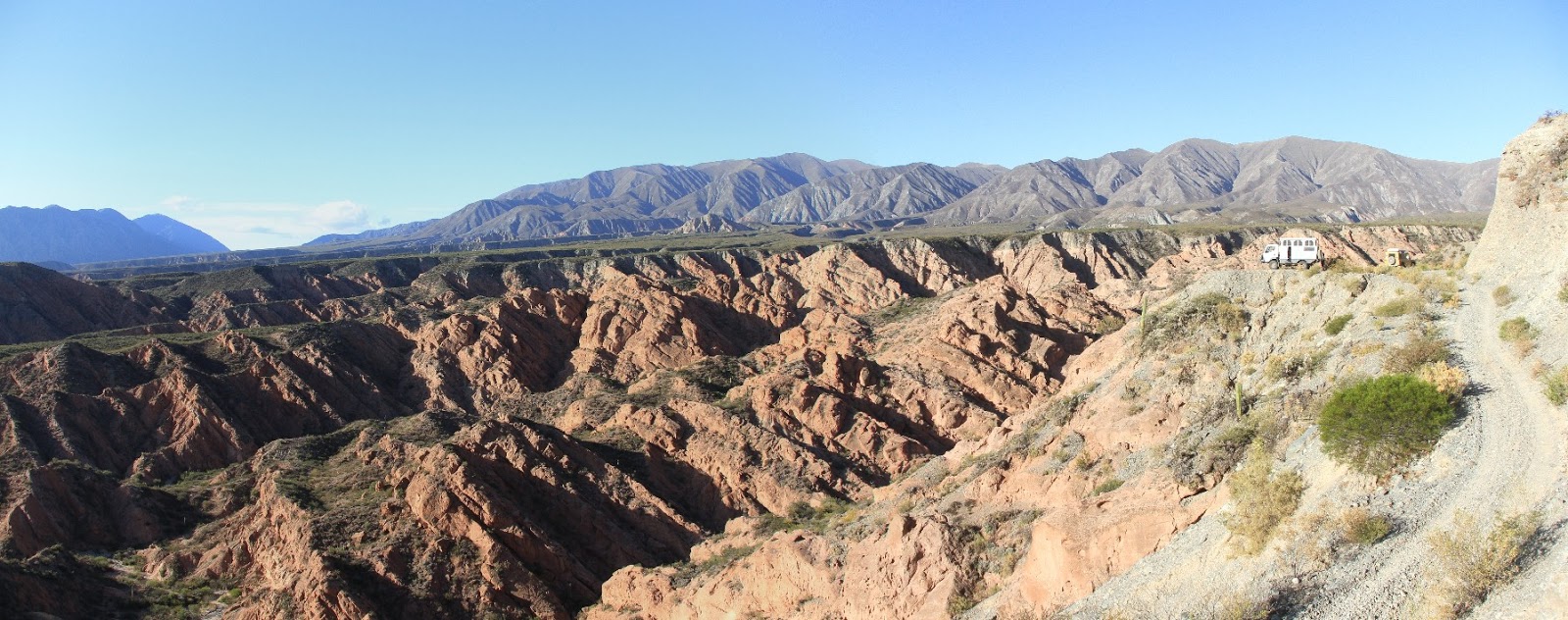
Vehicle. We travel in a right-hand drive 2010 Mitsubishi Fuso Canter powered by a 4.9 litre turbo-charged diesel engine, with a 5 speed 4x4 transmission and limited slip differential. The accommodation is built by an Australian company, Earth Cruiser.

Vehicle recovery. The Earth Cruiser is fitted with a WARN large-frame winch, an air compressor and Michelin XZL tires. On the pavement these tyres run at about 55psi (cold) but when things get rough we drop to around 40psi; and when it gets tough we will drop to 30psi (or even lower in a pinch). Tough going means mud, or loose sand. Loose, coarse, well-sorted gravel is really tough. The ability to adjust tire pressure as required is the most import technique we have; and sometimes more often than daily. We have a set of 4 gadgets to make letting down the tires faster and easier. Also we have a set of maxtrax when low tire pressure is not enough. Next comes the winch with a full set of heavy duty recovery gear (shackles, pullies, straps etc).

Tires. The tires are the Military spec Michelin XZL on 16" rims, with 2 spares. We also carry spare tubes, patches, and goop. One key bit of gear is a torque multiplier to get the wheel nuts loosened after being torqued up by pneumatic wrenches in the shop.

Mapping. We use a 10.5" ASUS Android tablet running Open Street Map (OSM) for our mapping. This has been an excellent solution.  A key feature is the ability to download maps for the entire South American continent (some 20GB) prior to venturing into regions far from the Internet. We use the Open Cycle Maps as a base because they have contours. We also installed the Trip Recording plugin to enable us to record our route in the gpx format; and use GpsPrune to consolidate prior to uploading to Google maps.

First Aid. We both have basic first-aid training and carry a basic kit.

Hiking. We carry a full set of hiking gear to enable multi-day excursions. All of the usual stuff: pack, sleeping bag & mat, tent, cooking gear, wet weather gear etc. Most of our hiking is however day walks.

Kayak. We carry an Advancedframe Convertible Inflatable Kayak which has proven excellent for exploring.

Photography. We have a Canon EOS-7D body with 3 lenses; 50mm; 10-20mm & 20-200mm Sigma. We also have a Ricoh CX2 which is excellent for macro work.

Internet. We purchase a local SIM in each country we visit; and sometimes two SIMs from different companies to improve coverage. Each country has a different requirement for registering the SIM, purchasing credit, and using the credit to purchase Internet data access. We then setup a blue-tooth tether from the Android phone to our other devices. We also use a Fusion2Go 3.0 RV signal booster to extend our effective range from the mobile phone towers. This setup facilitates Internet access away from the urban areas where WiFi may be found; however it is not without it's challenges. The SIM purchase is dirt cheap but the registration and initial setup is tricky in some countries and usually requires local assistance. Purchasing credit is usually easy at any small store or supermarket. Using credit to purchase Internet data is a bit different in each country but is usually easiest via a set of USSD codes typed into the keypad. Mobile phone towers are most common near urban areas; may offer LTE, 3G, 2G or nothing; and provide highly variable actual data thru-put, regardless of the signal quality.

Communications. Apart from the local SIM cards in each country we also carry a inmarsat phone & a SPOT device.

Spares. For the South American trip we are carrying just the basics for the Fuso (fan belt, compressor belt, air filters, fuel filter & oil filter). These have been necessary when servicing the vehicle in areas where Fuso is uncommon. We also carry a basic set of tools (drivers, spanners, sockets, files, drills, tap & die set, pliers, hammer) and general supplies (hose clamps, screws, bolts, electrical wire & connectors, cable ties, tape, & fencing wire).

5★ Bolivia 2017-11-07

The photo scarcely does this camp justice. We had followed a gravel road along a ridge-line and were presented with a jaw-dropping array of colors on the far side of a plunging valley. We spent the night perched in this wonderful place after being serenaded by a trumpet playing lad as he walked down from the school-bus to his village home. map

5★ Argentina, El Quenoal 2018-05-13

We had spent a week driving big days to traverse the length of Argentina to the extreme north-west corner and were handsomely rewarded with this site. The road was alarmingly narrow along an escarpment affording jaw-dropping views west over Bolivia. The only thru traffic was a woman, her improvised wheel barrow, and herdog the following morning. map

5★ Argentina, Tolombon 2018-05-09

We found ourselves leapfrogging a yellow land rover traveling north on the mundane ruta 40 and eventually stopped to meet our fellow travelers from South Africa. A minor gravel road to the east crossed the expansive valley, ground up a slow incline and then vaulted into a stunning, colorful, eroded terrain along an increasingly dodgey, narrow track to our vantage point. The company and view were excellent both. map

5★ Argentina Cabo San Pablo 2018-04-11

This was at the south-eastern extent of our travels on Terra Del Fuego. The challenging sandy ascent stopped just short of the utilitarian light-house and just a little further from it's concrete predecessor that has literally slipped off the ridge-line. The bay to the south was adorned with one of the many ships claimed by the region and the evening light was breathtaking. map

5★ Argentina Punta Ninfas Lighthouse 2018-03-06

After cooling our heels for a few days in Peurto Madrin we were glad to escape to a long straight road south-east, thru less inhabited terrain. After some 80km we arrive on dusk at the top of a commanding cliff over the Atlantic. Perfect. map

5★ Argentina El Tromen 2018-01-13

This remarkable location was dominated by a 15 meter wall of treacherously rough scoria. In the backdrop was an idyllic lake and the commanding Volcan Tromen replete with multiple ancient lava flows on it's flanks. Magnificent and belittling. map

5★ Argentina Parque Provinvial Laguan Daimante 2018-01-10

After a persistent climb up a valley into this little visited Park we were presented with a stunning high altitude lake bounded by volcano, mountain and this radiant slope. A diminutive track crept out south-west along the river to a clandestine border crossing to Chile (not open to us). map

5★ Argentina Parque Provinvial Laguan Daimante 2018-01-09

We arrived at the park entrance late in the evening to be told the park was closed until the following day, and the only available camp site was at the camp entrance. We indicated our intent to return tomorrow and the park officer directed us to this special spot on a natural platform overlooking a valley carved into the eastern side of the Andes. map

5★ Argentina Las Vegas 2018-01-08

Completely at odds with the namesake, this camp was up a steep little track to the side of our route. The exposed little knoll was witness to the Andes to the west and a violent thunder/snow storm that paraded around our eerie. map

5★ Argentina, Priest Road 2018-01-02

This remarkable narrow road traversing impossible granite boulders and ravines was attributed to the Priest Cura Gaucho, Jose Gabriel del Rosario Brochero. The stout bridges constructed with both keystone and suspension cables were remarkable. Our camp presided over our ascent and the view beyond. map

5★ Uruguay, San Gregorio De Polanco 2017-12-22

In the center of Uruguay there is nestled a glassy lake; and in the center of that lake there protrudes a sandy, forested isthmus; and on that isthmus there are many beautiful camps. map

5★ Peru 2017-10-01

We reached this late camp at an unnamed lake at 4884m altitude after a adventurous climb and a gallery of spectacular colors in the evening light. Cold, breathless and isolated. map

5★ Peru, Punta Olimpica 2017-09-25

The approach to this pass was spectacular up a steep paved road, with multiple switchbacks and glaciers hanging from the mountains. The ultimate summit was undercut by a tunnel but the old road to the original pass remained. We camped at 4670m altitude above the tunnel, and overlooking a stunning turquoise glacial lake. In the morning we attempted the original pass but were blocked by rock falls, and so reverted to the tunnel. map

5★ Peru, Surasaca 2017-08-08

We had a very interesting day and it was getting late as we headed north into Coordillera Huayhuash - famous for trekking, and infamous for violence done to trekkers. We found this camp within inches of Laguna Sura Saca at 4350m altitude. We enjoyed a visit from the local farmer, his brother and his son - a bright eyes lad of fifteen. The scenery was spectacular and we paddled the length of the lake in the morning, before a second visit from the lad - proudly on his pony. map

5★ Peru Chinchaycocha 2017-08-07

This expansive shallow lake is very close to the most distant tributary of the Amazon river. A partially constructed, and entirely under-utilized, visitor viewing area offered an ideal camp overlooking the waters and wildlife. map

5★ Peru Carpapata 2017-08-05.

We were traveling north along a relatively good, but very high gravel road in Peru, marveling at the potato farmers working the severe slopes. This camp was just 150m off the road, over the ridge-line and out of sight. On occasion, we could hear the political propaganda wafting up from the village, perhaps some 600m below, but entirely out of sight. It was cold at 4300m altitude. map

5★ Bolivia, Laguna Pastos Grandes 2017-07-01

This was the magnificent camp that didn't quite happen. We had arrived in Boliva a couple of days prior and covered some fantastic terrain to arrive at this superb location. We had settled in, and then it began to snow. We were in a remote location in Bolivia, at 4500m altitude in the Andes, at the beginning of winter, and it had started to snow. We fled. We fled some 20km back to a road which at least carried some regular traffic, and might conceivably be cleared of snow prior to Spring. It was -9℃ overnight and about 10cm of snow fell. map

5★ Chile, Caleta La Cichara 2017-06-25

We were heading north along the Pacific coast on a sealed road.  The road threaded a thin strip of land with the ocean on our left and to our right was a very steep slope of scree topped by a cliff of some 800m. A peninsula thrust out into the ocean, blocking passage so a tunnel had been constructed to under-come the impasse. Our map showed a minor road that passed up over the peninsula, probably the old road. We hoped for a camp on the old road but were concerned that the location would be blocked or dangerous due to the steady stream of rocks moving down the scree. To our astonishment the old road was maintained free and clear (possibly as a backup) and we camped above the tunnel in the ridge, safe from rockfalls. There was an abandoned car body and a spectacular view. map

5★ Chile CuadrillaDiez 2017-06-18

We had been traveling the Atacama desert for a couple of days and heading east towards a remote pass into Argentina. As the road began up a long slow incline we were set on edge by a number of burnt out car bodies. One front left wheel had been driven to destruction (not just the tyre, the wheel). We wondered if these were stolen cars used in drug running. We continued. The mountains started and then snow in the desert. Fortunately a big machine had cleared the snow and we continued - until we got to the point where the big machine had given up. We backtracked a little and climbed a little side track to an airy knoll at 3620m altitude, with 360° views. The altitude sickness set in later that evening. map

5★ Chile, El Totoral 2017-06-14

Still traveling North, but we had managed to escape Ruta 5 onto a minor road that bumped along the Pacific coast. We had passed a number of relatively informal gatherings of week-enders with a few permanent residents. The road degraded further to a sandy track amongst the rocky outcrops, but a spattering of very basic shacks persisted, each tucked into a isolated spot. Clearly these people valued the very same kind of isolation that we seek - and we did not wish to intrude. We finally found our little spot for the night, amongst a spectacularly craggy coastline, endorsed by the friendly wave of a local. map

5★ Chile, El Espino 2017-06-06

We were driving north along a desert valley and there was a very minor road zig-zagging up the range on our right. We gained 600m altitude up the switchbacks and were beginning to look for a place with a westerly view back over the valley, when we noticed a man approaching us out of the desert. We did not really want to talk with him because we were concerned he would move us on. He was a pretty scruffy lean character, with lanky hair, not a lot of teeth, and bright eyes. After some discussion in my very broken Spanish he became quite animated and was yabbering on at a great rate - and almost entirely unintelligible. I came to understand that he lived nearby and he knew of a wonderful spot for us to camp. He indicated a hill top to the east and provided instructions of how to get there. The light was fading fast as we navigated the increasingly marginal track. The position was truly spectacular with 360° views including a moon-rise to the east over the boarder with Peru. As the sun set I saw for the first time in my life the fabled green flash. As we departed the next morning I spied a man standing in a doorway of a small hut some distance off. We exchanged a wave. map

5★ Chile Vocan Ollague 2017-06-29

We asked the policeman at Ollague township if it was OK to drive up yonder Volcano. He simply shrugged in dismissal of such an odd question. So we began from the plain at 3720m altitude and picked our way up the unmaintained, rock strewn track up the western flank of Volcan Ollague. We camped at 5100m altitude on a tiny offshoot at the end of a hairpin bend on a ridge - so as to avoid any boulders the Volcan might send hurtling down. After a breathless night we continued our drive up to 5350m until the rockfalls were too thick - and we walked. A further 200m vertical and return in 2hrs. Awesome! map

★★★★★ camps

One of the great delights in traveling the way we do is the prospect spending our evenings and mornings in spectacular locations. The things that really make a location special for us include a superb view, a sense of isolation, exposure, extremes in geography or weather, and a cheeky position (internet access is a bonus). We usually start looking for a camp from 2-3 hours before dusk, and sometimes we end up camping in the dark (makes for an interesting sunrise). I select a single photo to try and capture the essence of each camp. There is also a map

Our most wonderful camps in South America include ....

Chile, Volcan Lliama 2017-05-23
Chile, Pichidangul 2017-06-05
Chile, El Espino 2017-06-06
Chile, El Totoral 2017-06-14
Chile, CuadrillaDiez 2017-06-18
Chile, Caleta La Cichara 2017-06-25
Chile, Vocan Ollague 2017-06-29
Bolivia, Laguna Pastos Grandes 2017-07-01
Peru, Carpapata 2017-08-05
Peru, Chinchaycocha 2017-08-07
Peru, Surasaca 2017-08-08
Peru, Punta Olimpica 2017-09-25
Peru, 2017-10-01
Bolivia, 2017-11-07
Uruguay, San Gregorio De Polanco 2017-12-22
Argentina, Priest Road 2018-01-02
Argentina, Las Vegas 2018-01-08
Argentina, Parque Provinvial Laguan Daimante 2018-01-09
Argentina, Parque Provinvial Laguan Daimante 2018-01-10
Argentina, El Tromen 2018-01-13
Argentina, Punta Ninfas Lighthouse 2018-03-06
Argentina, Cabo San Pablo 2018-04-11
Argentina, Tolombon 2018-05-09
Argentina, El Quenoal 2018-01-13


5★ Chile, Pichidangul 2017-06-05

We were traveling North on Chilli's main highway Ruta 5 - not our ideal. We exited into the town of Pichidangul jammed between Ruta 5 and the Pacific ocean in search of a camp. Before we even got thru town we were hailed by a local and invited back to her home so that her Canadian partner could interrogate us about our travels on her behalf. We found the camp just a kilometer out of town in close proximity to the crash of the Pacific. Astonishing that the whole area was used as the informal rubbish dump for the town. Somehow the locals did not appreciate the beauty on their own doorstep. map